
Tracing a Ridgefield Street Directory Trail
A useful Ridgefield street-by-street trail starts with a supplied address and keeps each record in its proper role. The assessor can identify a parcel owner or property name. AxisGIS can connect a street label to a parcel shape and nearby map layers. The Town Clerk’s land index can point to recorded parties and instruments. Historical directories can show a dated address listing, while the voter route has separate access and use limits. None of those sources is a complete list of people who are physically present. Work in order, save the record date, and mark an unresolved identity as unresolved.
- Normalize the address. Keep the street number, street name, suffix, unit, ZIP, parcel or MBL, and any alternate spelling. Use the eQuality street list and AxisGIS address box to catch a dropped unit or road suffix.
- Set the parcel anchor. Record the eQuality owner or name field, situs/location, property use, acres, zone, buildings, condominium complex, unique identifier, and update date. Treat the field as a property record, not a resident label.
- Inspect the map context. Search the same address in AxisGIS, note the parcel ID, and compare the road, orthophoto, zoning, flood/FEMA, and district layers. Adjacent parcels are map context, not a ready-made household list.
- Read the land index. Search SearchIQS Party 1 and Party 2 with exact and last-name-first variants. Add a date range, document group or description, town, book/page, instrument number, or case number when a name search is broad.
- Check a transfer lead. Use the Town Clerk’s monthly or annual PDF only to locate a date window and an instrument lead. Open the recorded document or ask the clerk before treating a transfer as a title fact.
- Use the voter route narrowly. SOTS offers an individual lookup route, while the statewide CSV costs $300 and carries strict permitted-use terms. No street-wide public mode was established in the research, so do not present a bulk file as a casual street search.
- Go backward for history. Search the listed Ridgefield directory years in both the alphabetical and street sections, then compare the result with Press, obituary, probate, deed, cemetery, and map evidence. A missing volume is a gap, not proof that an address had no household.
The result is a chain of dated source fields: address to parcel, parcel to recorded party, recorded party to a historical listing, and only then a carefully worded identity lead. That chain is more useful than a single name match.
Ridgefield Street Directory Record Map
Ridgefield has no single Fairfield County counter that contains every street record. The Town Clerk holds local land instruments and maps, the Assessor maintains the property-card layer, and different state or institutional custodians hold voter, court, vital, newspaper, and historical material. A street-by-street search works when the source is named beside the fact it can support.
| Record set | Keeper or portal | Street-level evidence | Access route |
|---|---|---|---|
| Property card | Ridgefield Assessor / eQuality | Owner or name field, situs, unit, MBL, unique ID, use, acres, zone, buildings, sales filters | Online search; Town Hall or assessor phone for questions |
| Parcel map | AxisGIS Ridgefield | Parcel shape, road, adjacent parcels, orthophoto, zoning, flood and district context | Public map viewer; confirm exact boundaries with deed or map |
| Deeds, mortgages and maps | Ridgefield Town Clerk / SearchIQS | Recorded parties, document type, date, book/page, instrument or case number | Online index, office copies, or written custodian request |
| Transfer reports | Town Clerk document center | Month, recorded date, book/page, property description, price, parties, document description, conveyance tax | Monthly and annual PDFs; verify the instrument |
| Tax bills | Ridgefield MyTaxBill | Property number/name and tax-bill category, with name search instructions | Online name or property search; taxpayer is not automatically an occupant |
| Permits and planning | Building Department / OpenGov | Address, application, documents, photos, inspections and certificates when available | Current account route, in-person payment, or FOI request |
| Historical directories and Press | Library, RHS and History Center | Dated address, name, phone, occupation or place of work, spouse or death notes, articles | Microfilm, local-history desks, physical volumes, or research service |
| Postal address | USPS | Normalized street, unit, city, state and ZIP | Exact-address lookup; result does not confirm a person or company |
| Voter registration | Connecticut SOTS and Ridgefield registrars | Public registration, party, status and participation fields allowed by law | Individual route or restricted file request; no street-wide mode confirmed |
The roles should not be blended. A tax mailing name may differ from a recorded owner. A historical directory address may describe a household at one date. A voter registration address may be protected, stale, or different from a property situs. Keeping those distinctions visible makes the address directory more accurate and safer to use.
Ridgefield eQuality Search Fields by Address
The Ridgefield property-card search is the most detailed address-keyed starting point. The vendor page says the assessment database was updated 06/30/2026 and explains that assessed value is 70% of estimated market value at the 2022 revaluation. Search can begin with a property-use category, an owner name in last-name-first form, a location number, a street, a unit, an MBL, a unique identifier, or a condominium complex. Use one category at a time, then press Search.
The live result headers are equally useful because they show what the record actually returns: Street Name, Number, Unit, Name, Uniqueid, MBL, Property Use, Acres, Zone, Buildings, and Condo Complex. The captured municipal sample uses Main Street, E150262, and E15-0262; it is a public parcel example, not a claim about a private resident. The card also exposes valuation, building, sales-history, and permit headings, so a researcher can keep a property fact separate from an occupancy guess.
The Ridgefield eQuality property-card search shows the field layout that should be used when a street name has several parcels or units.
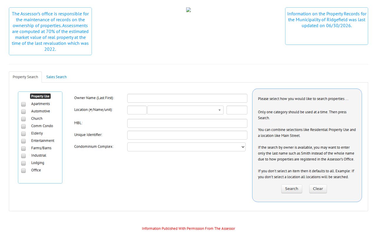
The search view is a parcel index. It does not reveal a private phone, a household roster, or proof that the named owner lives at the situs. Save the unique ID and MBL, then carry those anchors into AxisGIS and the land record search.
| eQuality field | How to use it in a street search |
|---|---|
| Property Use | Choose among the captured categories, such as Residential, Church, Farms/Barns, School, Special Purpose, or Vacant Land, when the property type matters. |
| Owner Name (Last First) | Start with last name only for a broad search, then add the first name or initial after the result set is clear. |
| Location number and Street name | Use the street number with the exhaustive Ridgefield street dropdown; examples include Branchville Road, Catoonah Street, Farmingville Road, and High Ridge Avenue. |
| Unit | Keep a unit or condominium identifier with the street number so separate parcels are not flattened into one address. |
| MBL | Use the municipal block-and-lot style identifier as a stable cross-check when a street spelling changes. |
| Unique Identifier | Carry the card or parcel ID into the result and map review; the captured sample is E150262. |
| Condominium Complex | Use the live dropdown for the authoritative list; visible examples included 16 Bailey Avenue Condominium and 24 North Street Condominium. |
| Sales Search filters | Separate mode with property type, sale dates, price, acres, MBL, zone, design, living area, year built, rooms, bedrooms, and baths. |
Note: The eQuality card is assessment evidence, so label it as owner, parcel, or property data rather than current resident evidence.
AxisGIS and the Ridgefield Street Grid
AxisGIS supplies the map bridge between a street spelling and a parcel. Its search prompt accepts a parcel number or address, and the documented parcel pattern is X00-0000. Select a parcel to reach the eQuality online property card or use the download control for the field-card PDF. The static configuration includes parcel and current-to-date 2024 map data, an orthophoto, zoning, flood/FEMA, and district, common, or state layers.
Use the map to compare a road segment with the parcel outline, not to announce who lives next door. A parcel click can help identify adjacent IDs, but the live layer menu and abutter report output were not captured in the research run. When a boundary matters, read the recorded map or deed. When a name matters, compare the card, instrument, and date. The Town and CAI describe the viewer as informational and warn against misuse.
The map is also a useful check on an address that appears in more than one form. Preserve the number, unit, MBL, and map date in your notes. A current GIS layer can orient the search even when an old directory uses a road name that no longer matches the present street field.
SearchIQS Land Records by Ridgefield Address
Ridgefield land records are held by the Town Clerk, not by a separate Fairfield County recorder. The Town’s land-record page links SearchIQS for an online owner-name route, while current SearchIQS Help describes the land index as 9/8/1959 to present and images as 5/31/1890 to present, with associated-book caveats. The same help material documents grantor/grantee index books from 1815 to 1960. The Town page advertises 1960 to present, so a cutoff conflict belongs in the research note rather than being silently resolved.
The SearchIQS Ridgefield availability and cutoff help explains the current coverage and the exact search controls. A grantor is the party conveying an interest; a grantee receives it. Search both sides, try last-name-first and spelling variants, and use an exact book/page, instrument number, or case number when one is known.
The help screen lists Party 1, Party 2, an option to ignore party type, Date From and Date Thru, Document Group, Document Description, Town, Book/Page, Instrument Number, Case Number, and Search. A wildcard * may help with a documented name pattern. The live Ridgefield screen was Cloudflare-gated in the capture, so no current deed row or recorded image should be invented.
The SearchIQS Help screen is the source for the Ridgefield index and image periods shown in the captured reference.
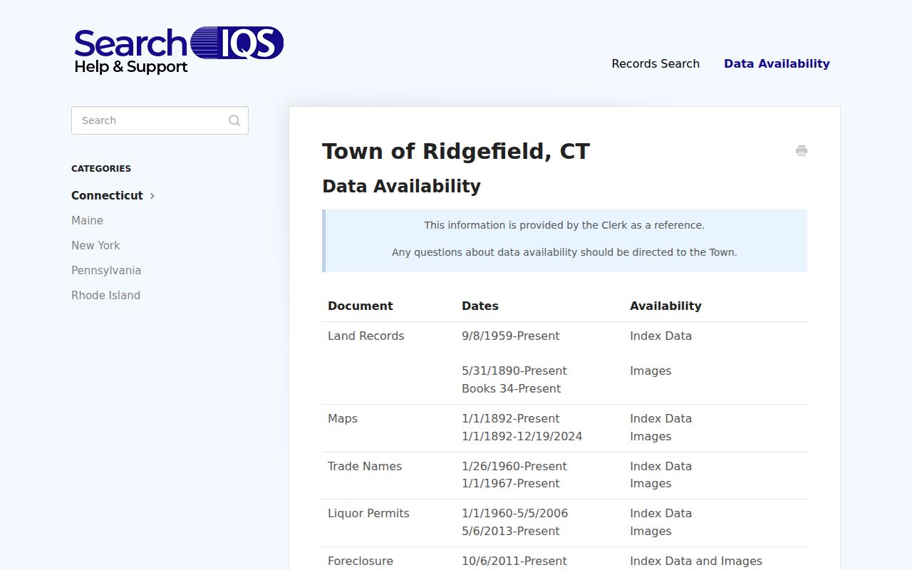
The current help page is more useful than a guessed cutoff because it records the live availability note and flags periods that need a Town Clerk check.
The SearchIQS Ridgefield land-record portal is the place to test the address and party fields. The Town Clerk warns that it does not perform title searches or give legal advice, and the most recent 30 days may not be audited. For a certified copy or an online gap, call the Town Clerk at 203-431-2783 or visit 400 Main Street.
The SearchIQS Ridgefield portal is the live entry point for a party or parcel search.
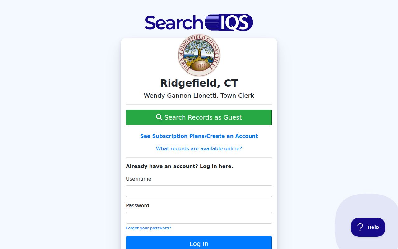
The portal image belongs beside the field notes, with the Cloudflare and cutoff limitations kept visible rather than replaced by an invented result.
- Parcel
- A mapped unit of land identified by a local number or ID. It is a research anchor, not a person.
- Situs address
- The physical location assigned to the property. It can differ from a tax mailing address.
- Plat or map
- A recorded drawing that helps show lots, roads, or boundaries. It does not replace the text of a deed.
- Criss-cross directory
- A historical directory organized by address or street as well as by name. It is a dated listing, not a current household map.
Ridgefield Transfer Reports by Address
The Town Clerk’s property-transfer document center is a practical recency check. Monthly and annual PDFs listed for 2024 through 2026 can reveal the month, recorded date, book and page, property description, price, grantor or seller, grantee or buyer, document description, and local conveyance tax. Those fields help locate the next instrument to inspect, but the PDF is a lead and not the recorded deed image.
The Ridgefield property-transfer document center is the source for those reports. In the July 2026 example, a first-page row identifies a 07/01/2026 recording, Book 1193 and Page 114, a 32 Lawson Lane property description, a $370,000 price, an Executor Deed, and $925 in local conveyance tax. The row shows how to read the report, not that a grantee moved into the property or that the transfer settles title.
For a sound address chain, move from the report to SearchIQS, inspect the instrument and any referenced map, then compare the property card and GIS parcel. If the index image is missing, ask the Town Clerk about the office copy route, current fees, and any period not yet audited.
The transfer report screenshot is best read as a lead sheet. Open the official transfer list before starting a dated address review.
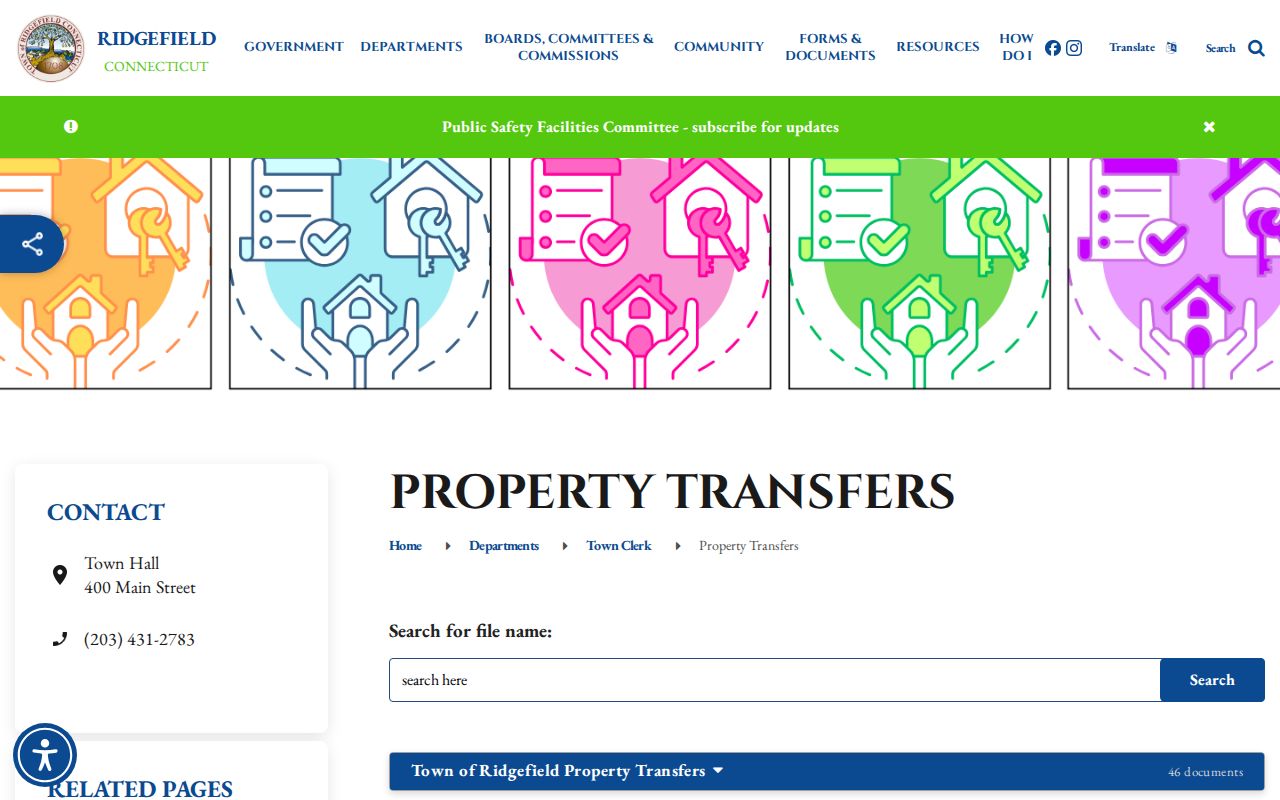
A transfer date can narrow a deed search, but it cannot supply the missing facts of occupancy, household size, or a person’s present location. Keep those questions separate.
Ridgefield Permit Records by Address
Permit and planning records add a different kind of address history. Ridgefield’s current OpenGov route can hold applications, documents, photos, inspections, and certificates, depending on department and record type. The town says a valid email or account is needed, online fees are paid up front with a card and processing charge, and cash or check may be used in person. Fields and fee controls are dynamic, so use the current screen rather than promising a fixed result layout.
The Ridgefield OpenGov permit and land-use portal is useful when an address search needs a building or planning lead. An older official ViewPermit guide gives a concrete fallback: choose Look up Permits, enter an address slowly, select the blue autocomplete result, select the blue address, use Attach Documents/Photos, and double-click a document to print. The older guide is not a promise that every historical file migrated to OpenGov.
Permit documents can explain a building change, inspection date, or certificate attached to a parcel. They do not identify every person connected with the address. If a record is not online, ask the Building Department or make a written Connecticut FOI Act request for existing, reasonably described records. A request can seek inspection first when copying cost matters.
The older Ridgefield address lookup instructions show the blue-address workflow used by the former portal.
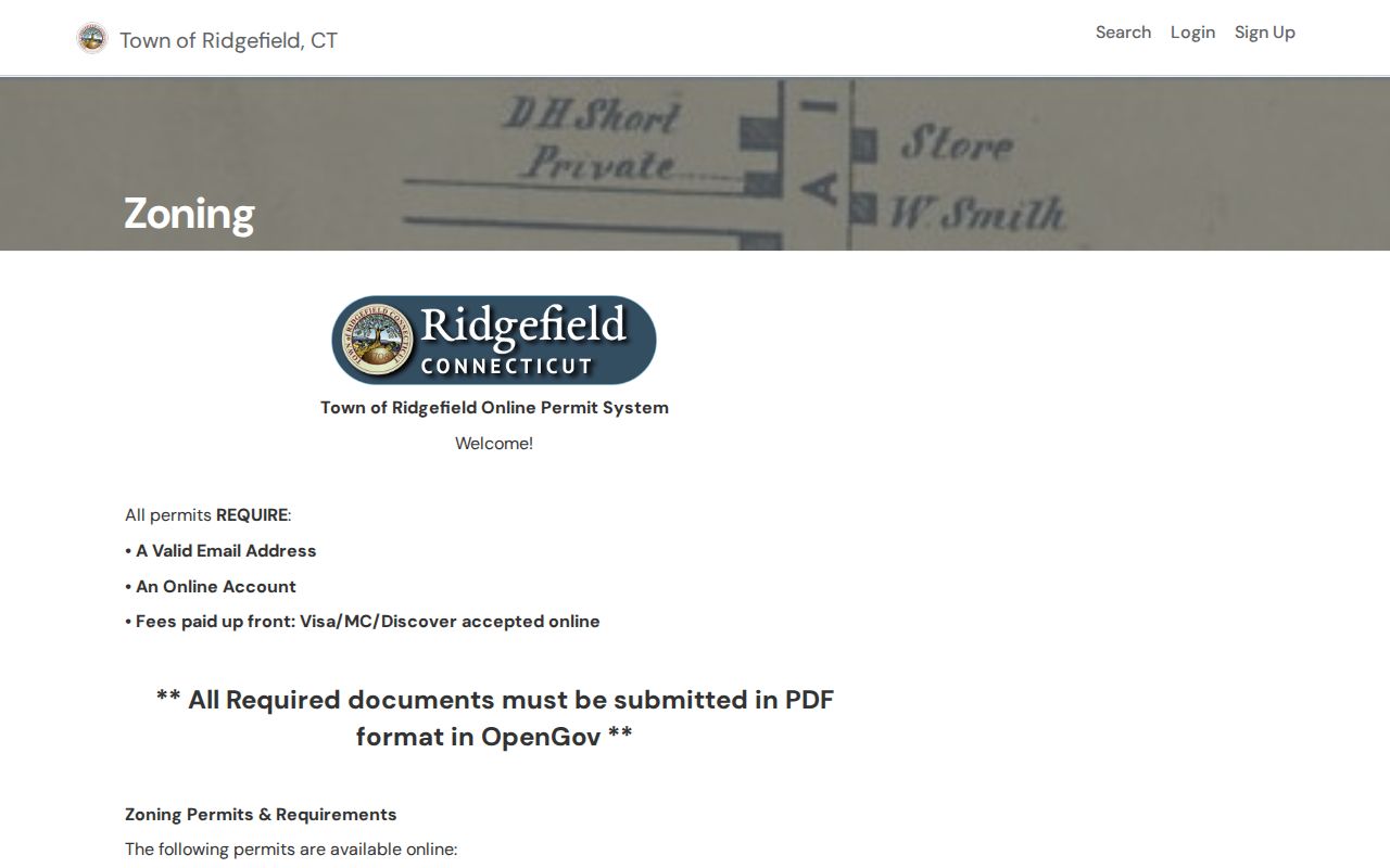
Read a permit as a dated property or project record. Pair it with the parcel ID and recorded map before drawing a conclusion about a household.
Ridgefield Street Names Across Three Maps
Address history in Ridgefield benefits from a dated map crosswalk. The Ridgefield Historical Society holds early maps through the early 2000s, including the 1867 Beers Atlas and 1912 Whitlock map. The Library of Congress provides a nine-sheet Ridgefield Sanborn set dated 1940, with sheets covering the period from August 1933 through March 1940. These sources can show an old route, building footprint, land use, or settlement reference that helps explain a directory entry.
Use Branchville, Ridgebury, Farmingville, Titicus, East Ridge, Main Street, Branchville Road, Danbury Road, Ethan Allen Highway, Mountainview, Hillsdale, and Island Hill as research terms when they appear in a map, meeting minute, Press story, or directory. Some are area or community references rather than formally bounded neighborhoods. A place name is a clue to compare, not a legal boundary claim.
No formal townwide readdressing, annexation, or street-renumbering story was located. If an old number does not match a current one, compare the deed description, road name, old directory street section, map sheet, and assessor record. Do not turn the mismatch into a local history fact without a source.
Note: Put the map year beside every historic address statement because a 1940 building map and a current parcel layer answer different questions.
Criss-Cross Address Entries in Ridgefield
The Bridgeport History Center finding aid lists Ridgefield volumes from 1958, 1960, 1962, 1964, 1966, 1968, 1973, 1975, 1977, 1979, 1981, 1983–1984, 1986, and 1988–1991. Beginning in 1895, Connecticut directories commonly used both alphabetical and street sections. The Ridgefield run has gaps, and the finding aid does not assign a publisher to each local volume, so inspect the title page rather than guessing.
A historical directory entry may contain a name, initials, address, telephone number, occupation or place of work, and sometimes spouse or death notes. Search the alphabetical section by surname and then the street section by number. Write down the edition year, exact spelling, abbreviation, and any “see” reference. A no-hit year may reflect a missing volume, a rural-route form, a changed number, or an index omission.
No official Ridgefield reverse or telephone-directory run was located. A street-listing section is not the same thing as a modern reverse lookup. For the collection years, holding locations, and reading method, use the Ridgefield Directory Book when the question turns historical rather than current.
The historical listing is strongest when paired with one independent field, such as a Press date, deed, map, obituary, cemetery note, or probate file. It remains a point-in-time record even when the same name appears across several years.
What a Ridgefield Address Record Cannot Show
An address directory cannot show every person associated with a street. Property cards and deeds speak to ownership or recorded interests. A tax bill speaks to a taxpayer or property name. A directory or Press item speaks to a date. None of those records reliably identifies guests, private household members, delivery recipients, utility customers, or a protected person whose address is withheld.
SOTS voter material also has a narrow role. Current Connecticut rules make only the birth year public, while the individual lookup fields were not captured in the research run. The $300 CSV request is limited to election-related, scholarly, journalistic, political, or governmental use and bars personal or private use, marketing, harassment, and reproduction. An ACP participant or a voter using the nondisclosure process should not be tested through another record system.
Lawful use. Use Ridgefield address records for personal, lawful research such as family history, civic records, or property history. Connecticut stalking law, including CGS §§53a-181c through 53a-181f, makes repeated monitoring, following, harassment, or unwanted contact a serious matter; read the current Connecticut stalking statute chapter for the legal text.
When a result is wrong, dated, protected, or incomplete, contact the custodian named in the record. The Connecticut FOI Act, CGS §§1-200 et seq., supports access to existing non-exempt records, but it does not require a clerk to create a resident list or certify an inference. The responsible stopping point is part of a reliable address record.
Note: A parcel, mailing address, voter address, historical address, and substitute address should remain separate labels in every Ridgefield record note.