
Ridgefield ZIP Code Coverage
The confirmed current postal picture for Ridgefield is narrow. Official municipal, Library, Historical Society, and community addresses reviewed in the research use 06877. The source set established no second five-digit ZIP serving the town, no PO-box-only ZIP, no unique-institution ZIP, and no ZIP split or realignment. That is a careful research conclusion, not a promise that every possible USPS delivery result has been captured.
| ZIP | Areas covered in the official source set | Post Office or station | Notes |
|---|---|---|---|
| 06877 | USPS city label is Ridgefield, Connecticut; no official neighborhood-by-neighborhood delivery list was located | Ridgefield Post Office, 26 Catoonah St, 06877-9998, 203-438-6561 | Only confirmed current five-digit ZIP in the reviewed source set; run USPS for the exact street and number |
The Ridgefield Post Office location record identifies the facility and its service information. For a counter or service question, the listed facility phone is 203-438-6561. Nearby USPS facilities in South Salem, New York, Georgetown, or West Redding are service locations, not proof that a Ridgefield street uses another ZIP. The only safe way to settle a mailing question is to run the exact address through USPS.
Searching Ridgefield ZIP Codes
A postal directory search should begin with a known address, not an assumption that a ZIP can produce a complete local resident list. USPS provides three distinct modes: by Address, by City and State, and Cities by ZIP Code. The first is the strongest mode for a supplied Ridgefield street because it keeps the number, unit, city, state, and postal result together.
- Run the exact address. Preserve the company field if relevant, street number and street name, apartment or suite, city, state, and the lookup date. Do not drop a unit.
- Check city and state. Use USPS’s city/state mode to compare the recognized city name with the address result. A city label is a postal convention, not a town-boundary ruling.
- Cross-check the parcel. Compare the street, number, unit, and ZIP result with eQuality’s street and owner fields, AxisGIS’s address or parcel prompt, and MyTaxBill’s property search. None of those local portals exposed a confirmed ZIP-wide resident filter.
- Use voter records only for a lawful question. SOTS provides an individual lookup route, while the CSV request costs $300 and limits use to election-related, scholarly, journalistic, political, or governmental purposes. The request form route uses SOTS LEAD by mail, email, or phone. It is not a casual ZIP roster.
- Narrow to the street. Once the postal result is clear, move to the Ridgefield Street Directory for address-keyed parcel and historical records, keeping the ZIP as one field rather than the identity.
No dynamic USPS result list was captured, and no official local portal supplied a ZIP-wide resident result in the research run. Mark a missing result as a gap. Do not create a second ZIP row or infer a full delivery area from a single mailing label.
Ridgefield ZIP Code USPS Fields
The USPS field set matters because each mode answers a different question. The address mode normalizes a supplied delivery point. The city and state mode checks a place label without a street. Cities by ZIP starts with a postal number and returns city names. The result notice says that a match does not confirm a person or company at the address.
| USPS field or mode | Required or optional | What it does |
|---|---|---|
| Company | Optional in address mode | Preserves an organization line when one is supplied; it does not prove a business is present. |
| Street Address | Required in address mode | Checks the street number and name for postal normalization. |
| Apt/Suite/Other | Optional | Keeps a unit or secondary delivery line attached to the result. |
| City | Required in city/state mode | Uses a recognized USPS city name; it is not a municipal boundary test. |
| State | Required in address and city/state modes | Pairs the place label with Connecticut or another selected state. |
| ZIP Code | Required in cities-by-ZIP mode | Starts with a five-digit postal code and returns its postal city information. |
| Find | Action | Runs the dynamic lookup; a missing rendered result should be reported, not filled from guesswork. |
The USPS ZIP Lookup Tool is the official normalization route. Use its result with the date and exact input preserved, especially when a historic address, unit, or rural road form is involved.
The Ridgefield postal facility record is a separate piece of evidence.
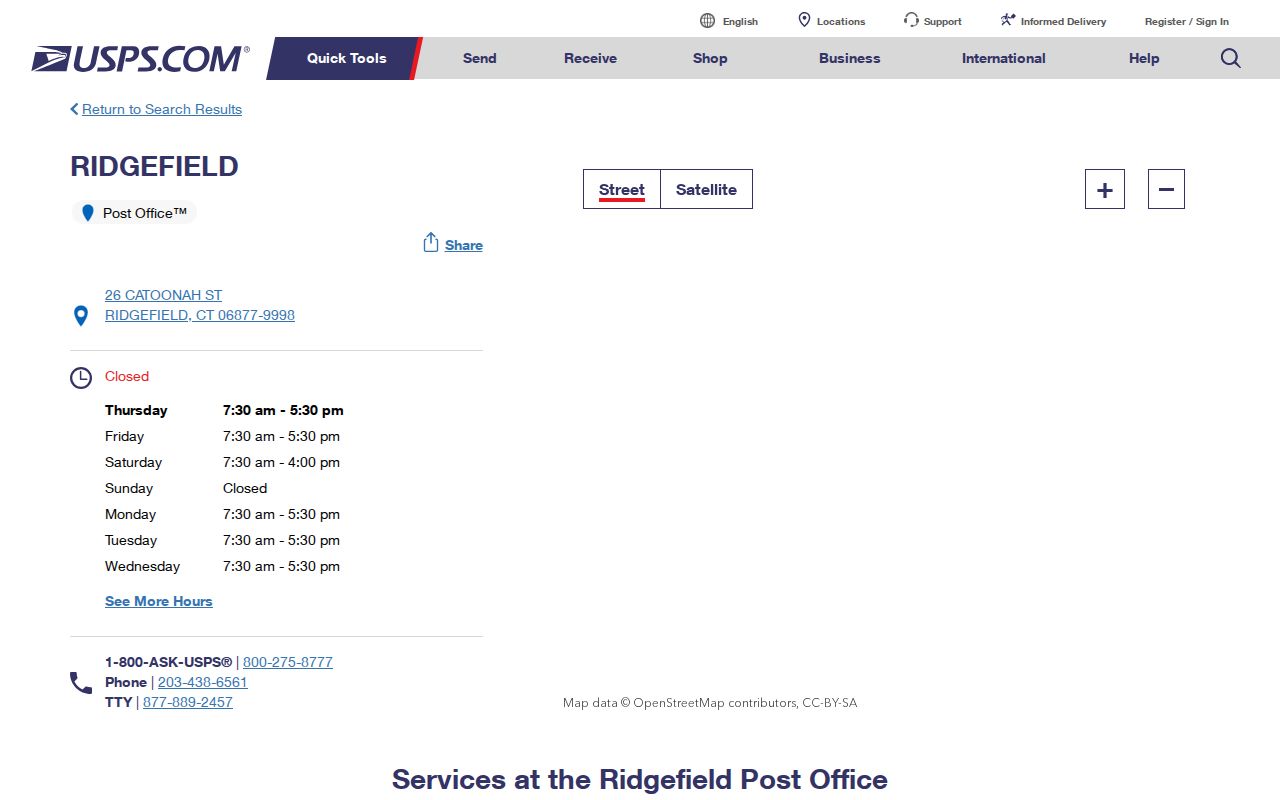
The facility record helps confirm the local post-office reference used in the coverage table. It still does not turn a ZIP or a counter location into a list of residents.
Ridgefield Postal Terms
Postal terms are easy to mix with property terms. Keep the ZIP layer separate from a situs address, parcel, mailing address, voter address, and tax record. A ZIP is assigned for delivery routing, while a ZIP+4 narrows the delivery segment. Neither is an identity field.
- ZIP code
- A five-digit USPS delivery area label. It can span a route or local edge and does not define Ridgefield’s legal boundary.
- ZIP+4
- The four added digits that narrow a delivery point, route, building, or other postal segment. It is not a separate town or resident record.
- PO-box ZIP
- A postal code used for boxes at a facility rather than a normal street delivery point. No Ridgefield PO-box-only ZIP was established in the reviewed sources.
- Unique ZIP
- A code assigned to one large institution or special destination. No Ridgefield unique-institution ZIP was confirmed.
- Carrier route
- A delivery grouping used by USPS to organize addresses. A carrier route is not a public household roster.
A definition can explain a returned label, but it cannot fill a missing local source. When the postal result and a parcel record differ, preserve both values and ask the proper custodian which one applies to the question.
Ridgefield ZIP Code Parcel Checks
Ridgefield’s local cross-checks are address and parcel tools, not ZIP-wide people indexes. eQuality uses property-use, owner, location number, street, unit, MBL, unique ID, condominium, and sales fields. AxisGIS accepts an address or parcel pattern such as `X00-0000` and links to an eQuality card. MyTaxBill searches by name, property number, or property name and separates Tax Bills from Sewer-Water-Misc. None of those captured screens exposes a confirmed ZIP filter for a complete resident set.
A tax search can still help resolve a postal mismatch. Search the property name or number, compare its street and unit with USPS, and keep the tax role in the note. The result may point to a taxpayer or property label, not to the person who receives mail or occupies the structure. The Ridgefield Town Clerk land-record route can then supply the deed or map description when the legal parcel, rather than the postal label, is the question.
The Ridgefield MyTaxBill property search shows why a tax route belongs beside, rather than inside, the postal route.
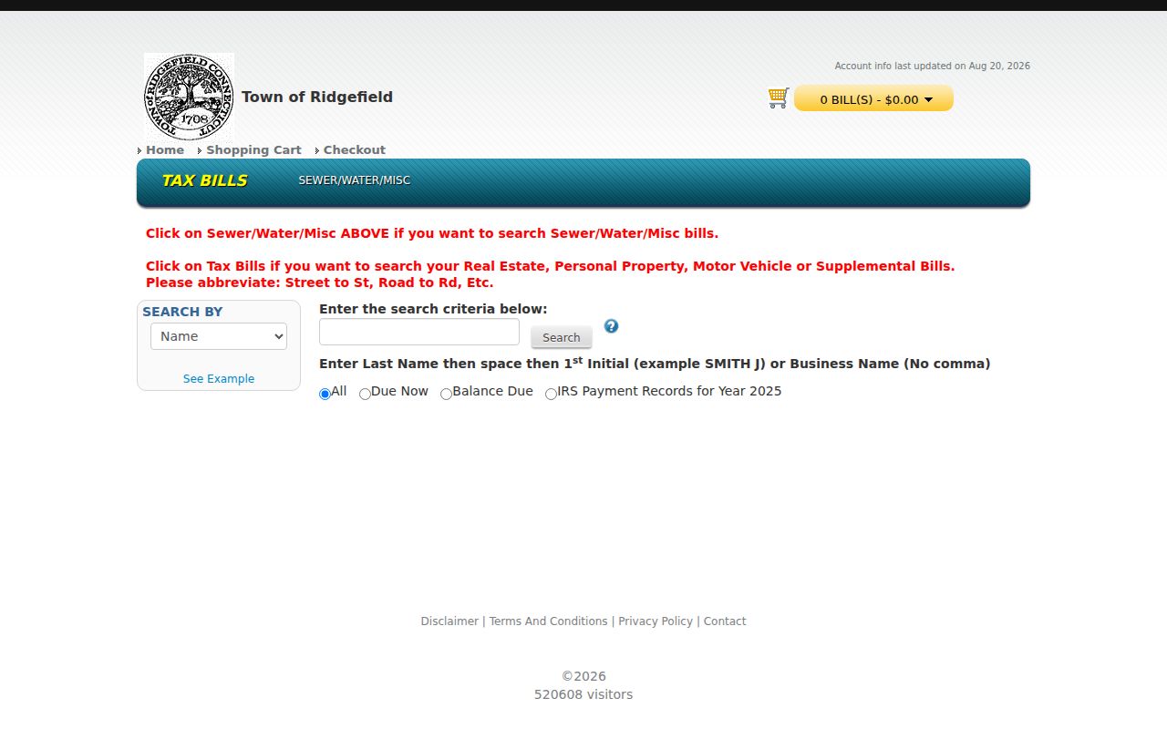
Use the bill portal as a property-number or property-name cross-check. Keep the ZIP result, parcel ID, and tax label in separate fields so a postal correction does not become an unsupported resident claim.
Note: A ZIP match is strongest for mail normalization when the street, number, unit, and city all agree; it remains weak for identity.
Ridgefield ZIP Codes and Town Lines
ZIP boundaries and municipal boundaries are different layers. A postal route can cross a town edge, use a recognized city label that differs from a legal municipality, or serve a delivery point without matching a parcel or voting district. For Ridgefield, the official source set did not establish a specific neighborhood mismatch, split, realignment, or alternate ZIP. Do not turn the absence of a captured boundary map into proof that postal and town lines always coincide.
The 06877 label appears consistently in reviewed Ridgefield municipal and institutional addresses. That consistency is useful, but it is not a complete USPS delivery-boundary study. The dynamic city/state result was not rendered, and no official neighborhood-by-neighborhood list was located. Run the exact street and number before assigning a ZIP to a parcel or person.
Postal boundary rule. Treat a ZIP as a delivery layer. Use the town assessor, GIS, deed, or registrar for parcel, land, election, or jurisdiction questions.
Nearby post offices listed by USPS are service choices, not evidence of a Ridgefield ZIP split. A claimed second ZIP needs an official exact-address result or a USPS source that clearly describes the assignment.
Ridgefield Geography and Delivery Areas
Place names help a postal search only when they are treated as search terms rather than formal boundaries. Ridgefield records use Branchville, Ridgebury, Farmingville, Titicus, East Ridge, Main Street, Mountainview, Hillsdale, and Island Hill. Planning minutes can mention an area or association without supplying a public roster. A USPS city label does not decide which of those names is a legally bounded neighborhood.
Use a place name to search maps, Press issues, meeting minutes, directory street sections, and historical collections. Then match the result to a street number, unit, parcel, or dated document. A place label without that anchor can return several roads or refer to a community reference rather than a postal delivery area.
That is why a Ridgefield postal directory should present geography as context. It can explain why a reader sees a familiar place name beside a postal label, but it should not manufacture a ZIP-by-neighborhood table that the official sources did not provide.
Note: Branchville, Ridgebury, Farmingville, and Titicus are useful Ridgefield search terms, not confirmed ZIP subdivisions in the researched source set.
Historic Ridgefield Maps and ZIP Clues
Historical maps can explain an address form without proving a current postal assignment. Ridgefield Historical Society collections include the 1867 Beers Atlas and 1912 Whitlock map, along with later road and district maps. The Library of Congress has a nine-sheet Ridgefield Sanborn set dated 1940, covering map work from August 1933 through March 1940. These sources can show an older road, building, land-use pattern, or route reference beside a modern street.
No formal townwide readdressing, ZIP realignment, ZIP split, or annexation story was located. If a historic number or road name differs from today’s USPS result, compare the map date with the deed, old directory street section, Press, and assessor card. A map can explain a name change or settlement pattern; it cannot fill an unrecorded USPS result. The Ridgefield Library local-history guide and in-person collection are useful fallback channels when a map or old address needs a human reading.
The same caution applies to old directories and census snapshots. They describe a date-specific household or address. Pair them with a modern postal check only when the research question calls for both periods.
Limits of a Ridgefield Postal Search
USPS gives an important notice: a normalized result does not confirm that a named person or company is at the address. A ZIP also does not prove ownership, occupancy, voter registration, school area, police jurisdiction, tax responsibility, or a household relationship. eQuality and AxisGIS add parcel evidence, while SOTS registration has public-field and use limits. None converts the postal code into a resident roster.
When a ZIP question needs a record held by Ridgefield, request the existing record from the proper custodian under the Connecticut FOI Act, CGS §§1-200 et seq. Identify the address, parcel, date, and record type. FOI can support inspection or copies of non-exempt records, but it does not require a new ZIP-wide list, disclose protected fields, or certify who lives at a delivery point. A person using the Address Confidentiality Program or voter nondisclosure process should not be located through another source.
A responsible postal directory states the confirmed 06877 finding, the USPS result gap, and the limits of every cross-check. If an exact address returns a different postal label, save the result, check the date, and ask USPS or the local custodian instead of adding a second ZIP to the table without evidence.
Lawful use. Use ZIP and address records for personal, lawful research, genealogy, civic context, or property history. Do not use a postal result to monitor, harass, follow, or expose a person, and do not work around a protected address.
Note: The best ZIP-based conclusion is often a normalized address plus a clear statement that no person was confirmed.